


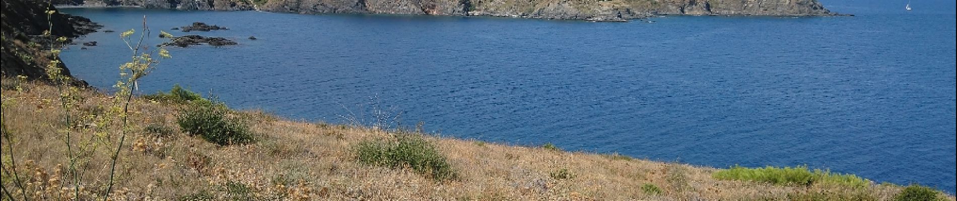
Les Aloès, la frontière Espagnole.

Gegetop
User
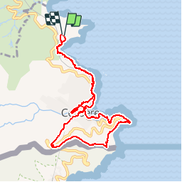

Length
10.8 km

Max alt
179 m

Uphill gradient
371 m
Km-Effort
15.8 km

Min alt
0 m

Downhill gradient
366 m
Boucle
Yes
Creation date :
2019-01-15 16:48:56.036
Updated on :
2019-01-15 16:48:56.036
3h58
Difficulty : Unknown

FREE GPS app for hiking
 SityTrail
IGN / Geographical institutes
SityTrail Plus
The world is yours!
About
Trail Nordic walking of 10.8 km to be discovered at Occitania, Pyrénées-Orientales, Cerbère. This trail is proposed by Gegetop.
Description
AR
Photos


Positioning
Country:
France
Region :
Occitania
Department/Province :
Pyrénées-Orientales
Municipality :
Cerbère
Location:
Unknown
Start:(Dec)
Start:(UTM)
513209 ; 4700313 (31T) N.
Comments