


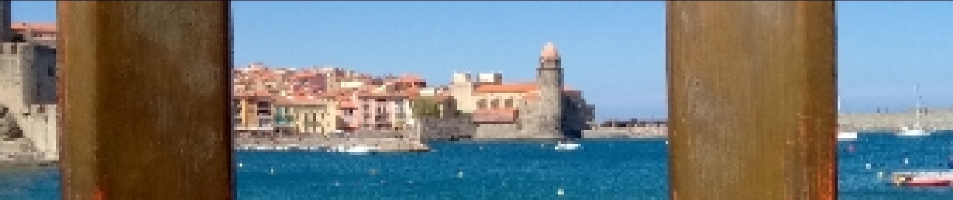
Les Paulilles - Collioure

Gegetop
User
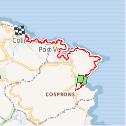

Length
15 km

Max alt
86 m

Uphill gradient
297 m
Km-Effort
19 km

Min alt
0 m

Downhill gradient
297 m
Boucle
No
Creation date :
2019-01-15 16:48:57.32
Updated on :
2019-01-15 16:48:57.32
4h03
Difficulty : Medium

FREE GPS app for hiking
 SityTrail
IGN / Geographical institutes
SityTrail Plus
The world is yours!
About
Trail Walking of 15 km to be discovered at Occitania, Pyrénées-Orientales, Port-Vendres. This trail is proposed by Gegetop.
Description
Par le sentier du littoral
Photos


Positioning
Country:
France
Region :
Occitania
Department/Province :
Pyrénées-Orientales
Municipality :
Port-Vendres
Location:
Unknown
Start:(Dec)
Start:(UTM)
509701 ; 4705188 (31T) N.
Comments