


W 2018 16 Mont de Rème

clabidault
User
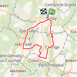

Length
12.7 km

Max alt
510 m

Uphill gradient
316 m
Km-Effort
16.9 km

Min alt
284 m

Downhill gradient
316 m
Boucle
Yes
Creation date :
2019-01-15 16:54:53.493
Updated on :
2019-01-29 10:37:11.665
3h36
Difficulty : Difficult

FREE GPS app for hiking
 SityTrail
IGN / Geographical institutes
SityTrail Plus
The world is yours!
About
Trail Walking of 12.7 km to be discovered at Bourgogne-Franche-Comté, Côte-d'Or, Nolay. This trail is proposed by clabidault.
Description
16 Participants groupe homogène
Positioning
Country:
France
Region :
Bourgogne-Franche-Comté
Department/Province :
Côte-d'Or
Municipality :
Nolay
Location:
Unknown
Start:(Dec)
Start:(UTM)
624001 ; 5201058 (31T) N.
Comments