


Lac des Vaches (Vanoise)

gregou74
User
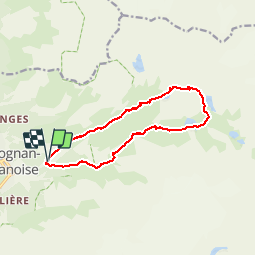

Length
12 km

Max alt
2517 m

Uphill gradient
858 m
Km-Effort
24 km

Min alt
1646 m

Downhill gradient
870 m
Boucle
Yes
Creation date :
2019-04-27 13:17:02.222
Updated on :
2019-04-27 13:17:02.269
4h40
Difficulty : Medium

FREE GPS app for hiking
 SityTrail
IGN / Geographical institutes
SityTrail Plus
The world is yours!
About
Trail Walking of 12 km to be discovered at Auvergne-Rhône-Alpes, Savoy, Pralognan-la-Vanoise. This trail is proposed by gregou74.
Positioning
Country:
France
Region :
Auvergne-Rhône-Alpes
Department/Province :
Savoy
Municipality :
Pralognan-la-Vanoise
Location:
Unknown
Start:(Dec)
Start:(UTM)
322724 ; 5027858 (32T) N.
Comments