


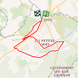
Lorris la rigole de courpalet

BRASSENS
User

Length
15.5 km

Max alt
141 m

Uphill gradient
98 m
Km-Effort
16.8 km

Min alt
115 m

Downhill gradient
99 m
Boucle
Yes
Creation date :
2019-01-15 16:59:28.269
Updated on :
2019-01-15 16:59:28.269
3h19
Difficulty : Medium

FREE GPS app for hiking
 SityTrail
IGN / Geographical institutes
SityTrail Plus
The world is yours!
About
Trail Walking of 15.5 km to be discovered at Centre-Loire Valley, Loiret, Lorris. This trail is proposed by BRASSENS.
Positioning
Country:
France
Region :
Centre-Loire Valley
Department/Province :
Loiret
Municipality :
Lorris
Location:
Unknown
Start:(Dec)
Start:(UTM)
463360 ; 5304058 (31T) N.
Comments