Trail Mountain bike Beautheil-Saints - Espace VTT FFC - Les Coteaux du Morin et de l'Aubetin - Circuit n° 18 - Boucle 2 - Saints - Photo

Espace VTT FFC - Les Coteaux du Morin et de l'Aubetin - Circuit n° 18 - Boucle 2 - Saints

 tracegps
tracegps

User

© OpenStreetMap contributors
Length
Length
38 km
Max alt
Max alt
156 m
Uphill gradient
Uphill gradient
431 m
Km-Effort
Km-Effort  
44 km
Min alt
Min alt
73 m
Downhill gradient
Downhill gradient
431 m
Boucle
Boucle
Yes
Creation date :
2014-12-10 00:00:00.0
Updated on :
2014-12-10 00:00:00.0

(1 Reviews)

Mountain bike
Mountain bike
2h45
Difficulty : Difficult

Scan this QR Code to open this trail in the SityTrail application

FREE GPS app for hiking

Logo SityTrail SityTrail

IGN / Geographical institutes

Download SityTrail from the App Store Download SityTrail from Google Play

Logo SityTrail SityTrail World

The world is yours!

Download SityTrail from the App Store Download SityTrail from Google Play Download SityTrail on Huawei AppGallery

About

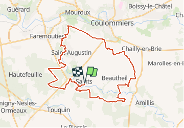
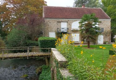
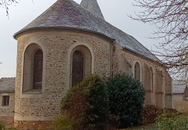
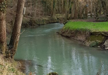
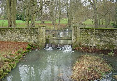
Trail Mountain bike of 38 km to be discovered at Ile-de-France, Seine-et-Marne, Beautheil-Saints. This trail is proposed by tracegps.

Description

Espace VTT FFC - Les Coteaux du Morin et de l'Aubetin - Circuit n° 18 - Boucle 2 - Saints - Mauperthuis - Saint Augustin – Beautheil Départ : Circuit n°14 (Saints) A la portée des amateurs désirant accroître leur rayon d’action Points d’accueils • Office du tourisme : 7 rue du Général de Gaulle - 77120 COULOMMIERS Tél. : 01 64 03 88 09 - mail : off.tourisme@coulommiers.fr • Vélo Nature : 8 avenue de Strasbourg - 77120 COULOMMIERS Tél. : 01 64 20 84 42 - mail : velonature@tele2.fr • Association cycliste partenaire Association Cycliste Pommeuse Boissy (ACPB) Site internet : http://acpommeuseboissy.free.fr

Elevation profile

Photos

Positioning

Country:
France
Region :
Ile-de-France
Department/Province :
Seine-et-Marne
Municipality :
Beautheil-Saints
Location:
Unknown
Start:(UTM)
503523 ; 5400584 (31U) N.

Comments

Please log in to post a review or rate the element


super


Trails nearby

Trail Mountain bike Saint-Augustin - Espace VTT FFC - Les Coteaux du Morin et de l'Aubetin - Circuit n° 15 - Saint Augustin - Photo
Mountain bike
tracegps

Mountain bike

Medium
(1)
Saint-Augustin, Ile-de-France, Seine-et-Marne, France
12 km | 14.4 km-effort
1h 0min
Yes
Trail Walking Faremoutiers - Faremoutiers - Photo
Walking
PatRando

Walking

Easy
Faremoutiers, Ile-de-France, Seine-et-Marne, France
22 km | 25 km-effort
5h 26min
Yes
Trail Walking Beautheil-Saints - Saints - Photo
Walking
Bernardroland

Walking

Easy
Beautheil-Saints, Ile-de-France, Seine-et-Marne, France
18.4 km | 21 km-effort
5h 10min
Yes
Trail Walking Touquin - Touquin - Photo
Walking
Bernardroland

Walking

Very easy
Touquin, Ile-de-France, Seine-et-Marne, France
17.7 km | 20 km-effort
4h 10min
Yes
Trail Walking Lumigny-Nesles-Ormeaux - Tour de Lumigny - Nesles - Ormeaux - Photo
Walking
tracegps

Walking

Very difficult
Lumigny-Nesles-Ormeaux, Ile-de-France, Seine-et-Marne, France
16.8 km | 18.4 km-effort
4h 10min
Yes
Trail Walking Beautheil-Saints - Saint  - Photo
Walking
pikibangi

Walking

Very difficult
Beautheil-Saints, Ile-de-France, Seine-et-Marne, France
23 km | 26 km-effort
4h 48min
Yes
Trail Walking Le Plessis-Feu-Aussoux - Plessis-Feu-Aussoux - Photo
Walking
pikibangi

Walking

Very difficult
Le Plessis-Feu-Aussoux, Ile-de-France, Seine-et-Marne, France
18.2 km | 20 km-effort
4h 17min
Yes
Trail Walking Mauperthuis - mauperthuis - Photo
Walking
teddy75

Walking

Very difficult
Mauperthuis, Ile-de-France, Seine-et-Marne, France
25 km | 29 km-effort
6h 3min
Yes
Trail Mountain bike Touquin - Espace VTT FFC - Les Coteaux du Morin et de l'Aubetin - Circuit n° 16 - Touquin - Photo
Mountain bike
tracegps

Mountain bike

Medium
Touquin, Ile-de-France, Seine-et-Marne, France
13.6 km | 14.9 km-effort
1h 0min
Yes


Close
My subscriptions