


100 miles du sud 2018

gsouque
User

Length
111 km

Max alt
2194 m

Uphill gradient
5546 m
Km-Effort
187 km

Min alt
-1 m

Downhill gradient
6202 m
Boucle
No
Creation date :
2019-01-15 17:08:13.099
Updated on :
2019-01-15 17:08:13.099
40h00
Difficulty : Very difficult

FREE GPS app for hiking
 SityTrail
IGN / Geographical institutes
SityTrail Plus
The world is yours!
About
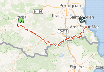
Trail Running of 111 km to be discovered at Occitania, Pyrénées-Orientales, Vernet-les-Bains. This trail is proposed by gsouque.
Positioning
Country:
France
Region :
Occitania
Department/Province :
Pyrénées-Orientales
Municipality :
Vernet-les-Bains
Location:
Unknown
Start:(Dec)
Start:(UTM)
449801 ; 4710767 (31T) N.
Comments