


la tour de la madelone

jeanic63
User

Length
16.9 km

Max alt
638 m

Uphill gradient
653 m
Km-Effort
26 km

Min alt
37 m

Downhill gradient
654 m
Boucle
Yes
Creation date :
2019-01-15 17:21:42.105
Updated on :
2019-08-22 12:52:09.371
--
Difficulty : Difficult
5h37
Difficulty : Unknown

FREE GPS app for hiking
 SityTrail
IGN / Geographical institutes
SityTrail Plus
The world is yours!
About
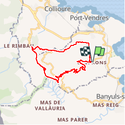
Trail On foot of 16.9 km to be discovered at Occitania, Pyrénées-Orientales, Port-Vendres. This trail is proposed by jeanic63.
Description
départ hameau de cospron entre port vendre et Banyuls dans le 66
Positioning
Country:
France
Region :
Occitania
Department/Province :
Pyrénées-Orientales
Municipality :
Port-Vendres
Location:
Unknown
Start:(Dec)
Start:(UTM)
508878 ; 4704976 (31T) N.
Comments