


W 2018 15 Saint Romain (rando douce)

clabidault
User
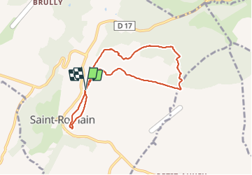

Length
7.4 km

Max alt
459 m

Uphill gradient
142 m
Km-Effort
9.3 km

Min alt
380 m

Downhill gradient
139 m
Boucle
Yes
Creation date :
2019-01-15 17:29:41.791
Updated on :
2019-01-29 10:32:43.741
2h11
Difficulty : Medium

FREE GPS app for hiking
 SityTrail
IGN / Geographical institutes
SityTrail Plus
The world is yours!
About
Trail Walking of 7.4 km to be discovered at Bourgogne-Franche-Comté, Côte-d'Or, Saint-Romain. This trail is proposed by clabidault.
Description
16 Participants beau soleil bonne ambiance.
Randonnée facile beau point de vue depuis le château fort.
Positioning
Country:
France
Region :
Bourgogne-Franche-Comté
Department/Province :
Côte-d'Or
Municipality :
Saint-Romain
Location:
Unknown
Start:(Dec)
Start:(UTM)
630319 ; 5206951 (31T) N.
Comments