


Badonviller_22kms

ZAMBAUX
User
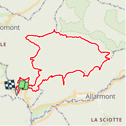

Length
22 km

Max alt
666 m

Uphill gradient
649 m
Km-Effort
31 km

Min alt
371 m

Downhill gradient
651 m
Boucle
Yes
Creation date :
2019-04-27 09:34:24.362
Updated on :
2019-04-27 09:34:24.422
6h30
Difficulty : Medium

FREE GPS app for hiking
 SityTrail
IGN / Geographical institutes
SityTrail Plus
The world is yours!
About
Trail Walking of 22 km to be discovered at Grand Est, Meurthe-et-Moselle, Angomont. This trail is proposed by ZAMBAUX.
Positioning
Country:
France
Region :
Grand Est
Department/Province :
Meurthe-et-Moselle
Municipality :
Angomont
Location:
Unknown
Start:(Dec)
Start:(UTM)
348961 ; 5372022 (32U) N.
Comments