Trail Mountain bike Hermival-les-Vaux - Randonnée VTT de la Cerza 25 Kms - Lisieux - Photo

Randonnée VTT de la Cerza 25 Kms - Lisieux

 tracegps
tracegps

User

© OpenStreetMap contributors
Length
Length
19.3 km
Max alt
Max alt
165 m
Uphill gradient
Uphill gradient
281 m
Km-Effort
Km-Effort  
23 km
Min alt
Min alt
77 m
Downhill gradient
Downhill gradient
281 m
Boucle
Boucle
Yes
Creation date :
2014-12-10 00:00:00.0
Updated on :
2014-12-10 00:00:00.0

(0 Reviews)

Mountain bike
Mountain bike
2h00
Difficulty : Medium

Scan this QR Code to open this trail in the SityTrail application

FREE GPS app for hiking

Logo SityTrail SityTrail

IGN / Geographical institutes

Download SityTrail from the App Store Download SityTrail from Google Play

Logo SityTrail SityTrail World

The world is yours!

Download SityTrail from the App Store Download SityTrail from Google Play Download SityTrail on Huawei AppGallery

About

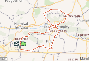
Trail Mountain bike of 19.3 km to be discovered at Normandy, Calvados, Hermival-les-Vaux. This trail is proposed by tracegps.

Description

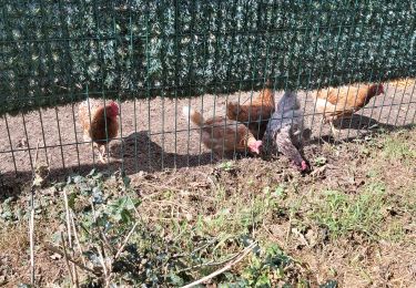
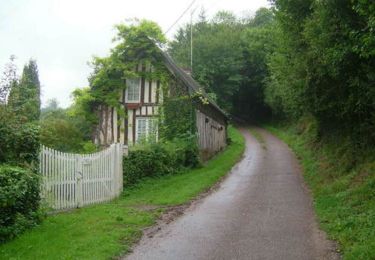
La fameuse Randonnée qui démarre au niveau de l'Hippodrome de Lisieux et qui a lieu au mois de Novembre. La particularité de cette randonnée c'est qu'elle passe au cœur du Zoo de Cerza sur Hermival les Vaux mais en temps normal cela n'est pas possible. Alors ce tracé est une variante et vous aurez peut-être le loisir d'observer les animaux de la Savane car un chemin de randonnée longe cette partie du zoo. Une autre partie très intéressante c'est la traversée du bois de Firfol, alors bonne randonnée et profitez du paysage.

Elevation profile

Positioning

Country:
France
Region :
Normandy
Department/Province :
Calvados
Municipality :
Hermival-les-Vaux
Location:
Unknown
Start:(UTM)
301653 ; 5447398 (31U) N.

Trails nearby

Trail Mountain bike Le Mesnil-Guillaume - Randonnée VTT du Mesnil Guillaume le 30/05/2010 23 km - Photo
Mountain bike
tracegps

Mountain bike

Difficult
(1)
Le Mesnil-Guillaume, Normandy, Calvados, France
22 km | 27 km-effort
2h 0min
Yes
Trail Walking Glos - Au tour. De GLOS - Photo
Walking
pauldurand

Walking

Glos, Normandy, Calvados, France
9 km | 10.9 km-effort
3h 20min
Yes
Trail Walking Hermival-les-Vaux - Hermival les Vaux - Photo
Walking
werth

Walking

Medium
Hermival-les-Vaux, Normandy, Calvados, France
18.2 km | 22 km-effort
5h 12min
Yes
Trail Mountain bike Glos - Autour de Glos - Photo
Mountain bike
tracegps

Mountain bike

Difficult
Glos, Normandy, Calvados, France
39 km | 50 km-effort
2h 30min
Yes
Trail Walking Lisieux - Autour de la Basilique de Lisieux - Photo
Walking
tracegps

Walking

Difficult
Lisieux, Normandy, Calvados, France
18.7 km | 23 km-effort
4h 30min
Yes
Trail Walking Ouilly-du-Houley - Ouille du Houley - Photo
Walking
Eve - Line

Walking

Medium
Ouilly-du-Houley, Normandy, Calvados, France
11.3 km | 14.4 km-effort
3h 9min
Yes
Trail Walking Lisieux - Gare de Lisieux/St Cyr du Ronceray  - Photo
Walking
Eve - Line

Walking

Easy
Lisieux, Normandy, Calvados, France
16.4 km | 18.6 km-effort
3h 19min
No
Trail Walking Hermival-les-Vaux - roque - Photo
Walking
serisier

Walking

Very easy
Hermival-les-Vaux, Normandy, Calvados, France
23 km | 28 km-effort
6h 0min
Yes
Trail Mountain bike Courtonne-la-Meurdrac - Rando de Courtonne La Meurdrac - Photo
Mountain bike
tracegps

Mountain bike

Difficult
Courtonne-la-Meurdrac, Normandy, Calvados, France
30 km | 36 km-effort
2h 30min
Yes


Close
My subscriptions