


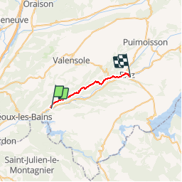
GR4-J05 - St-Martin de brome - Riez

nfranche
User

Length
17.5 km

Max alt
602 m

Uphill gradient
431 m
Km-Effort
23 km

Min alt
361 m

Downhill gradient
255 m
Boucle
No
Creation date :
2019-01-15 17:57:48.101
Updated on :
2019-01-15 17:57:48.101
5h32
Difficulty : Medium

FREE GPS app for hiking
 SityTrail
IGN / Geographical institutes
SityTrail Plus
The world is yours!
About
Trail Walking of 17.5 km to be discovered at Provence-Alpes-Côte d'Azur, Alpes-de-Haute-Provence, Saint-Martin-de-Brômes. This trail is proposed by nfranche.
Positioning
Country:
France
Region :
Provence-Alpes-Côte d'Azur
Department/Province :
Alpes-de-Haute-Provence
Municipality :
Saint-Martin-de-Brômes
Location:
Unknown
Start:(Dec)
Start:(UTM)
737097 ; 4850521 (31T) N.
Comments