


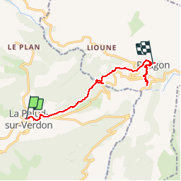
GR4-J09 - Moustiers - Rougon

nfranche
User

Length
11.7 km

Max alt
970 m

Uphill gradient
508 m
Km-Effort
18.4 km

Min alt
694 m

Downhill gradient
476 m
Boucle
No
Creation date :
2019-01-15 17:57:51.537
Updated on :
2019-01-15 17:57:51.537
4h44
Difficulty : Medium

FREE GPS app for hiking
 SityTrail
IGN / Geographical institutes
SityTrail Plus
The world is yours!
About
Trail Walking of 11.7 km to be discovered at Provence-Alpes-Côte d'Azur, Alpes-de-Haute-Provence, La Palud-sur-Verdon. This trail is proposed by nfranche.
Positioning
Country:
France
Region :
Provence-Alpes-Côte d'Azur
Department/Province :
Alpes-de-Haute-Provence
Municipality :
La Palud-sur-Verdon
Location:
Unknown
Start:(Dec)
Start:(UTM)
285972 ; 4850832 (32T) N.
Comments