Ouffières

phi14
User

Length
10.4 km

Max alt
167 m

Uphill gradient
210 m
Km-Effort
13.1 km

Min alt
20 m

Downhill gradient
206 m
Boucle
Yes
Creation date :
2019-01-15 17:59:44.103
Updated on :
2019-01-15 17:59:44.103
2h20
Difficulty : Easy

FREE GPS app for hiking
 SityTrail
IGN / Geographical institutes
SityTrail Plus
The world is yours!
About
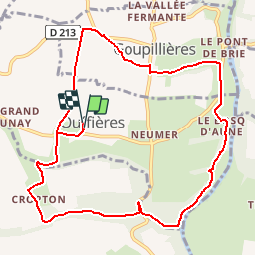
Trail Walking of 10.4 km to be discovered at Normandy, Calvados, Ouffières. This trail is proposed by phi14.
Positioning
Country:
France
Region :
Normandy
Department/Province :
Calvados
Municipality :
Ouffières
Location:
Unknown
Start:(Dec)
Start:(UTM)
683400 ; 5433127 (30U) N.
Comments