Trail Walking Fay-sur-Lignon - Lac de Saint Front depuis  Fay sur Lignon - Photo

Lac de Saint Front depuis Fay sur Lignon

 tracegps
tracegps

User

© OpenStreetMap contributors
Length
Length
17.2 km
Max alt
Max alt
1350 m
Uphill gradient
Uphill gradient
414 m
Km-Effort
Km-Effort  
23 km
Min alt
Min alt
1107 m
Downhill gradient
Downhill gradient
412 m
Boucle
Boucle
Yes
Creation date :
2014-12-10 00:00:00.0
Updated on :
2014-12-10 00:00:00.0

(1 Reviews)

Walking
Walking
4h30
Difficulty : Medium

Scan this QR Code to open this trail in the SityTrail application

FREE GPS app for hiking

Logo SityTrail SityTrail

IGN / Geographical institutes

Download SityTrail from the App Store Download SityTrail from Google Play

Logo SityTrail SityTrail World

The world is yours!

Download SityTrail from the App Store Download SityTrail from Google Play Download SityTrail on Huawei AppGallery

About

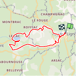
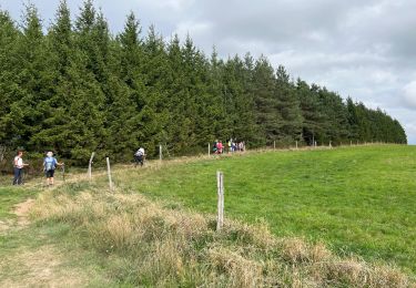
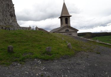
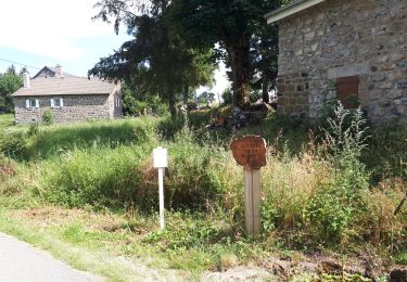
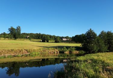
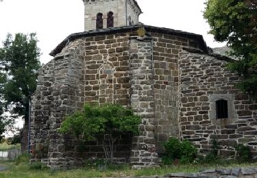
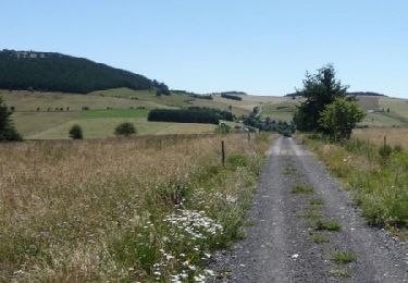
Trail Walking of 17.2 km to be discovered at Auvergne-Rhône-Alpes, Haute-Loire, Fay-sur-Lignon. This trail is proposed by tracegps.

Description

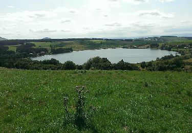
De Fay sur Lignon au maar de Saint Front.

Elevation profile

Positioning

Country:
France
Region :
Auvergne-Rhône-Alpes
Department/Province :
Haute-Loire
Municipality :
Fay-sur-Lignon
Location:
Unknown
Start:(UTM)
596682 ; 4982133 (31T) N.

Comments

Please log in to post a review or rate the element


Super


Trails nearby

Trail Walking Saint-Front - Tour du lac St Front - Photo
Walking
mallovon

Walking

Medium
(1)
Saint-Front, Auvergne-Rhône-Alpes, Haute-Loire, France
8.5 km | 10.6 km-effort
2h 17min
Yes
Trail Cycle Saint-Clément - ST CLEMENT - Photo
Cycle
eric.mechin

Cycle

Very easy
(1)
Saint-Clément, Auvergne-Rhône-Alpes, Ardèche, France
62 km | 85 km-effort
Unknown
No
Trail Walking Saint-Clément - Circuit près de Fay sur LIGNON  - Photo
Walking
Jean-MarieFaux

Walking

Difficult
Saint-Clément, Auvergne-Rhône-Alpes, Ardèche, France
10 km | 12.3 km-effort
2h 27min
No
Trail Walking Mazet-Saint-Voy - Volamont - Photo
Walking
mallovon

Walking

Easy
Mazet-Saint-Voy, Auvergne-Rhône-Alpes, Haute-Loire, France
5 km | 6.7 km-effort
2h 32min
Yes
Trail Walking Saint-Front - massif des roches - Photo
Walking
Nicolesophie08

Walking

Medium
Saint-Front, Auvergne-Rhône-Alpes, Haute-Loire, France
15.8 km | 0 m-effort
7h 11min
No
Trail Walking Les Vastres - Villelonge-Les Vastres PR - Photo
Walking
mallovon

Walking

Very easy
Les Vastres, Auvergne-Rhône-Alpes, Haute-Loire, France
14 km | 17 km-effort
3h 47min
No
Trail Walking Mazet-Saint-Voy - Baignade du moulin de Boyer - Photo
Walking
mallovon

Walking

Very easy
Mazet-Saint-Voy, Auvergne-Rhône-Alpes, Haute-Loire, France
3.7 km | 4.8 km-effort
1h 29min
Yes
Trail Walking Saint-Clément - St Clément - Photo
Walking
mallovon

Walking

Medium
Saint-Clément, Auvergne-Rhône-Alpes, Ardèche, France
4.3 km | 6.3 km-effort
1h 24min
Yes
Trail Equestrian Fay-sur-Lignon - Sentier des Narces de Chaudeyrolles - Fay sur Lignon - Photo
Equestrian
tracegps

Equestrian

Medium
Fay-sur-Lignon, Auvergne-Rhône-Alpes, Haute-Loire, France
24 km | 32 km-effort
4h 58min
Yes


Close
My subscriptions