


Donon-Sentier Casemates Sud

geranimo
User
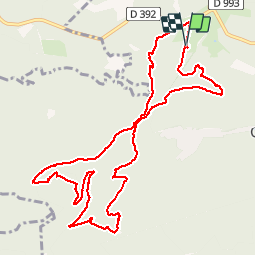

Length
12.6 km

Max alt
892 m

Uphill gradient
323 m
Km-Effort
16.9 km

Min alt
729 m

Downhill gradient
321 m
Boucle
Yes
Creation date :
2019-01-15 19:11:59.341
Updated on :
2019-11-02 18:05:12.062
3h35
Difficulty : Medium

FREE GPS app for hiking
 SityTrail
IGN / Geographical institutes
SityTrail Plus
The world is yours!
About
Trail Walking of 12.6 km to be discovered at Grand Est, Bas-Rhin, Grandfontaine. This trail is proposed by geranimo.
Positioning
Country:
France
Region :
Grand Est
Department/Province :
Bas-Rhin
Municipality :
Grandfontaine
Location:
Unknown
Start:(Dec)
Start:(UTM)
362746 ; 5373891 (32U) N.
Comments