


St Laurent la Vernède 281118

fario
User
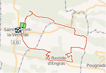

Length
11.8 km

Max alt
270 m

Uphill gradient
215 m
Km-Effort
14.6 km

Min alt
165 m

Downhill gradient
220 m
Boucle
No
Creation date :
2019-01-15 19:21:29.559
Updated on :
2019-01-15 19:21:29.559
2h58
Difficulty : Easy

FREE GPS app for hiking
 SityTrail
IGN / Geographical institutes
SityTrail Plus
The world is yours!
About
Trail Walking of 11.8 km to be discovered at Occitania, Gard, Saint-Laurent-la-Vernède. This trail is proposed by fario.
Description
Rando très sympa autour de st laurent, en chemin Menhir (super) , le lavoir, la chapelle et le fort .
Positioning
Country:
France
Region :
Occitania
Department/Province :
Gard
Municipality :
Saint-Laurent-la-Vernède
Location:
Unknown
Start:(Dec)
Start:(UTM)
616628 ; 4884754 (31T) N.
Comments