


Beynes - Verneuil reco

NUITEVEN
User
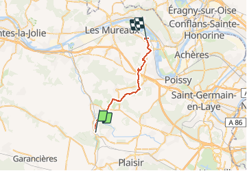

Length
23 km

Max alt
190 m

Uphill gradient
370 m
Km-Effort
28 km

Min alt
21 m

Downhill gradient
417 m
Boucle
No
Creation date :
2019-01-15 19:37:40.123
Updated on :
2020-01-18 16:09:12.196
5h41
Difficulty : Unknown

FREE GPS app for hiking
 SityTrail
IGN / Geographical institutes
SityTrail Plus
The world is yours!
About
Trail Walking of 23 km to be discovered at Ile-de-France, Yvelines, Beynes. This trail is proposed by NUITEVEN.
Positioning
Country:
France
Region :
Ile-de-France
Department/Province :
Yvelines
Municipality :
Beynes
Location:
Unknown
Start:(Dec)
Start:(UTM)
417670 ; 5412290 (31U) N.
Comments