


teyssieu

ludol
User
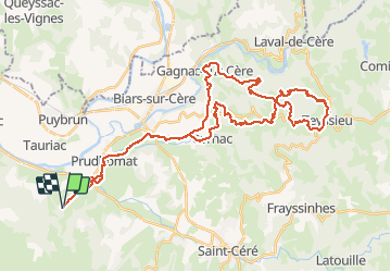

Length
51 km

Max alt
464 m

Uphill gradient
1284 m
Km-Effort
69 km

Min alt
127 m

Downhill gradient
1283 m
Boucle
Yes
Creation date :
2019-01-15 19:52:53.959
Updated on :
2019-01-15 19:52:53.959
4h10
Difficulty : Unknown

FREE GPS app for hiking
 SityTrail
IGN / Geographical institutes
SityTrail Plus
The world is yours!
About
Trail Other activity of 51 km to be discovered at Occitania, Lot, Loubressac. This trail is proposed by ludol.
Positioning
Country:
France
Region :
Occitania
Department/Province :
Lot
Municipality :
Loubressac
Location:
Unknown
Start:(Dec)
Start:(UTM)
404292 ; 4970067 (31T) N.
Comments