


Sain Étienne Le Frioul

trailer.nono
User
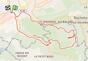

Length
12.3 km

Max alt
994 m

Uphill gradient
552 m
Km-Effort
19.6 km

Min alt
570 m

Downhill gradient
552 m
Boucle
Yes
Creation date :
2019-01-15 20:07:54.751
Updated on :
2019-01-15 20:07:54.751
1h30
Difficulty : Medium

FREE GPS app for hiking
 SityTrail
IGN / Geographical institutes
SityTrail Plus
The world is yours!
About
Trail Running of 12.3 km to be discovered at Auvergne-Rhône-Alpes, Loire, Saint-Étienne. This trail is proposed by trailer.nono.
Positioning
Country:
France
Region :
Auvergne-Rhône-Alpes
Department/Province :
Loire
Municipality :
Saint-Étienne
Location:
Unknown
Start:(Dec)
Start:(UTM)
609149 ; 5029734 (31T) N.
Comments