


sainteolive

jpfrobert
User
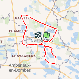

Length
15 km

Max alt
299 m

Uphill gradient
86 m
Km-Effort
16.2 km

Min alt
268 m

Downhill gradient
87 m
Boucle
Yes
Creation date :
2019-01-15 20:16:02.448
Updated on :
2019-01-15 20:16:02.448
--
Difficulty : Easy

FREE GPS app for hiking
 SityTrail
IGN / Geographical institutes
SityTrail Plus
The world is yours!
About
Trail Mountain bike of 15 km to be discovered at Auvergne-Rhône-Alpes, Ain, Sainte-Olive. This trail is proposed by jpfrobert.
Positioning
Country:
France
Region :
Auvergne-Rhône-Alpes
Department/Province :
Ain
Municipality :
Sainte-Olive
Location:
Unknown
Start:(Dec)
Start:(UTM)
649245 ; 5097914 (31T) N.
Comments