


canet plage

bellouelo46
User
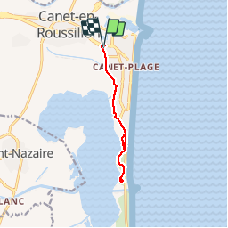

Length
10.1 km

Max alt
5 m

Uphill gradient
29 m
Km-Effort
10.4 km

Min alt
-2 m

Downhill gradient
29 m
Boucle
Yes
Creation date :
2019-01-15 20:28:22.23
Updated on :
2019-01-15 20:28:22.23
1h21
Difficulty : Easy

FREE GPS app for hiking
 SityTrail
IGN / Geographical institutes
SityTrail Plus
The world is yours!
About
Trail Nordic walking of 10.1 km to be discovered at Occitania, Pyrénées-Orientales, Canet-en-Roussillon. This trail is proposed by bellouelo46.
Description
petite sortie étang de canet
Positioning
Country:
France
Region :
Occitania
Department/Province :
Pyrénées-Orientales
Municipality :
Canet-en-Roussillon
Location:
Unknown
Start:(Dec)
Start:(UTM)
501987 ; 4727246 (31T) N.
Comments