


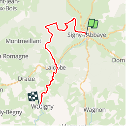

18.2 km | 23 km-effort

User


FREE GPS app for hiking
 SityTrail
IGN / Geographical institutes
SityTrail World
The world is yours!
Trail Walking of 18.1 km to be discovered at Grand Est, Ardennes, Signy-l'Abbaye. This trail is proposed by tracegps.
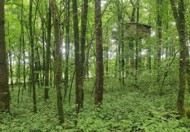
Le Chemin de Compostelle, voie de Vézelay GR654® présenté par le Comité Régional du Tourisme de Champagne-Ardenne Chemin de Compostelle, Voie de Vézelay GR654® De Signy l’Abbaye à Wasigny Troisième étape. Cette étape pour permettra de découvrir la région du Porcien, en traversant la forêt de Signy-l’Abbaye et en longeant la vallée de la Vau. Vous trouverez le descriptif détaillé de cette randonnée dans le Topo-guide® de la Fédération Française de la Randonnée Pédestre.


Walking

Mountain bike
Mountain bike
Walking
Walking


sport

Mountain bike
Mountain bike
Walking