Trail Walking Haverskerque - Circuit du Tannay - Haverskerque - Photo

Circuit du Tannay - Haverskerque

 tracegps
tracegps

User

© OpenStreetMap contributors
Length
Length
5.9 km
Max alt
Max alt
26 m
Uphill gradient
Uphill gradient
32 m
Km-Effort
Km-Effort  
6.3 km
Min alt
Min alt
12 m
Downhill gradient
Downhill gradient
31 m
Boucle
Boucle
Yes
Creation date :
2014-12-10 00:00:00.0
Updated on :
2014-12-10 00:00:00.0

(1 Reviews)

Walking
Walking
1h30
Difficulty : Easy

Scan this QR Code to open this trail in the SityTrail application

FREE GPS app for hiking

Logo SityTrail SityTrail

IGN / Geographical institutes

Download SityTrail from the App Store Download SityTrail from Google Play

Logo SityTrail SityTrail World

The world is yours!

Download SityTrail from the App Store Download SityTrail from Google Play Download SityTrail on Huawei AppGallery

About

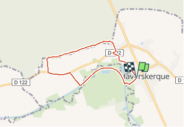
Trail Walking of 5.9 km to be discovered at Hauts-de-France, Nord, Haverskerque. This trail is proposed by tracegps.

Description

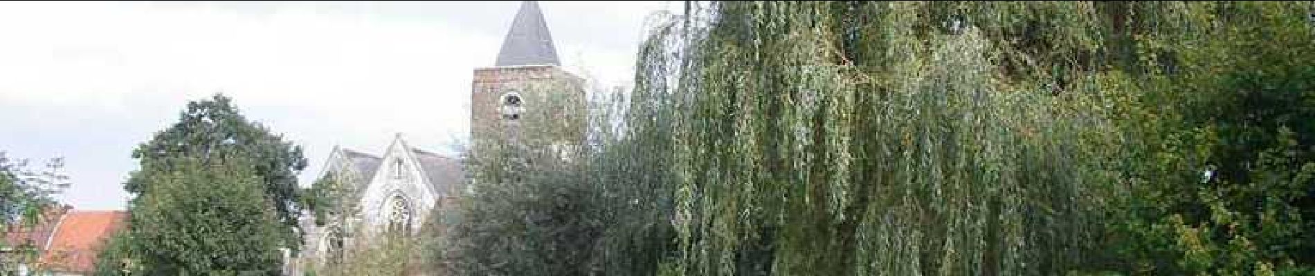
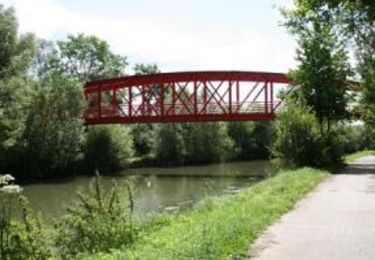
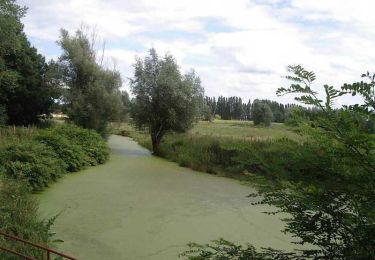
Départ de l’église d’Haverskerque Circuit entre les berges du canal de la Lys et la lisière de la forêt domaniale de Nieppe. Attention, pendant la période de chasse, l’accès à la lisière de la forêt peut être interdit. Retrouvez cette randonnée sur le site du Comité Départemental du Tourisme du Nord.

Elevation profile

Photos

Positioning

Country:
France
Region :
Hauts-de-France
Department/Province :
Nord
Municipality :
Haverskerque
Location:
Unknown
Start:(UTM)
467392 ; 5609934 (31U) N.

Comments

Please log in to post a review or rate the element


Petite randonnée très agréable faite avec mon fils de 7 ans 🌳❤️


Trails nearby

Trail Walking Haverskerque - Haverskerque 3 clochers 10.8 km - Photo
Walking
Blourouce

Walking

Medium
(1)
Haverskerque, Hauts-de-France, Nord, France
10.8 km | 11.5 km-effort
2h 36min
Yes
Trail Other activity Saint-Venant - le_sentier_des_deux_ecluses - Photo
Other activity
LaHAL

Other activity

Medium
Saint-Venant, Hauts-de-France, Pas-de-Calais, France
12.5 km | 13 km-effort
Unknown
Yes
Trail Walking Guarbecque - 2015-08-24T22:07:05Z - Photo
Walking
samsam62

Walking

Very easy
(2)
Guarbecque, Hauts-de-France, Pas-de-Calais, France
38 km | 42 km-effort
9h 7min
Yes
Trail Walking Haverskerque - Circuit des 3 clochers (Haverskerque) - Photo
Walking
tracegps

Walking

Medium
Haverskerque, Hauts-de-France, Nord, France
10.8 km | 11.5 km-effort
2h 45min
Yes
Trail Walking Morbecque - En passant par Caudescure - Photo
Walking
temmichel

Walking

Difficult
Morbecque, Hauts-de-France, Nord, France
12.4 km | 13.5 km-effort
3h 3min
Yes
Trail On foot Robecq - ROBECQ 12.7 km et 46m de déniv. - Photo
On foot
eaea7charles

On foot

Easy
Robecq, Hauts-de-France, Pas-de-Calais, France
12.8 km | 13.4 km-effort
3h 0min
Yes
Trail Walking Morbecque - rando les 3 clochers haverskerque - Photo
Walking
charline meurant

Walking

Very easy
Morbecque, Hauts-de-France, Nord, France
4.8 km | 5 km-effort
3h 9min
No
Trail Walking Saint-Venant - saint VENANT - Photo
Walking
eaea7charles

Walking

Easy
Saint-Venant, Hauts-de-France, Pas-de-Calais, France
12.5 km | 13.1 km-effort
2h 55min
Yes
Trail Walking Morbecque - Arborétum de Morbecque - Photo
Walking
Bernard.voyageur

Walking

Easy
Morbecque, Hauts-de-France, Nord, France
6.5 km | 6.8 km-effort
1h 31min
Yes


Close
My subscriptions