


Randonnée au Mont Ventoux par face nord

tracegps
User
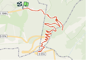

Length
9.3 km

Max alt
1907 m

Uphill gradient
527 m
Km-Effort
16.3 km

Min alt
1400 m

Downhill gradient
527 m
Boucle
Yes
Creation date :
2014-12-10 00:00:00.0
Updated on :
2014-12-10 00:00:00.0
5h00
Difficulty : Difficult

FREE GPS app for hiking
 SityTrail
IGN / Geographical institutes
SityTrail Plus
The world is yours!
About
Trail Walking of 9.3 km to be discovered at Provence-Alpes-Côte d'Azur, Vaucluse, Beaumont-du-Ventoux. This trail is proposed by tracegps.
Description
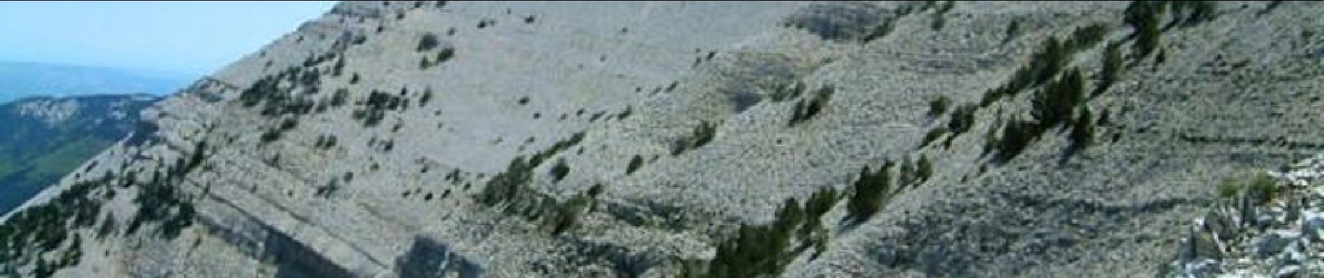
L'ascension du Mont Ventoux par sa face Nord, site magnifique! Randonnée proposée par « Les Balades et Randonnées de Fred »
Photos

Positioning
Country:
France
Region :
Provence-Alpes-Côte d'Azur
Department/Province :
Vaucluse
Municipality :
Beaumont-du-Ventoux
Location:
Unknown
Start:(Dec)
Start:(UTM)
681649 ; 4894893 (31T) N.
Comments
balcons nord
Tour du Viso