


10 mai 2018 jour 6

dudu85
User

Length
32 km

Max alt
22 m

Uphill gradient
129 m
Km-Effort
33 km

Min alt
-3 m

Downhill gradient
142 m
Boucle
No
Creation date :
2019-05-06 10:49:56.158
Updated on :
2019-05-06 10:49:56.158
7h29
Difficulty : Easy

FREE GPS app for hiking
 SityTrail
IGN / Geographical institutes
SityTrail Plus
The world is yours!
About
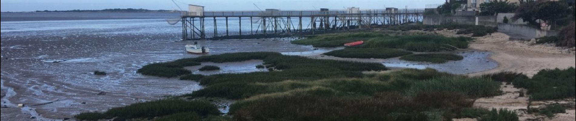
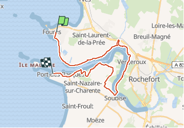
Trail Walking of 32 km to be discovered at New Aquitaine, Charente-Maritime, Fouras. This trail is proposed by dudu85.
Description
Fouras - passeur de Soubise - Port des Barques
Photos


Positioning
Country:
France
Region :
New Aquitaine
Department/Province :
Charente-Maritime
Municipality :
Fouras
Location:
Unknown
Start:(Dec)
Start:(UTM)
648171 ; 5094424 (30T) N.
Comments