


Taviet 2019

r.genette
User
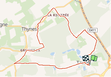

Length
10.7 km

Max alt
302 m

Uphill gradient
226 m
Km-Effort
13.8 km

Min alt
199 m

Downhill gradient
226 m
Boucle
Yes
Creation date :
2019-05-06 11:37:45.856
Updated on :
2019-05-06 11:37:45.856
2h57
Difficulty : Easy

FREE GPS app for hiking
 SityTrail
IGN / Geographical institutes
SityTrail Plus
The world is yours!
About
Trail Walking of 10.7 km to be discovered at Wallonia, Namur, Dinant. This trail is proposed by r.genette.
Description
Chemins fermiers et sentiers..
un peu de route..
Positioning
Country:
Belgium
Region :
Wallonia
Department/Province :
Namur
Municipality :
Dinant
Location:
Sorinnes
Start:(Dec)
Start:(UTM)
644119 ; 5570255 (31U) N.
Comments