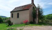
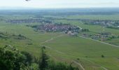
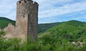
Trail Walking Kaysersberg-Vignoble - De Kaysersberg à l'auberge Saint-Alexis - Photo

De Kaysersberg à l'auberge Saint-Alexis

 tracegps
tracegps

User

© OpenStreetMap contributors
Length
Length
12.9 km
Max alt
Max alt
695 m
Uphill gradient
Uphill gradient
578 m
Km-Effort
Km-Effort  
21 km
Min alt
Min alt
245 m
Downhill gradient
Downhill gradient
580 m
Boucle
Boucle
Yes
Creation date :
2014-12-10 00:00:00.0
Updated on :
2014-12-10 00:00:00.0

(0 Reviews)

Walking
Walking
4h00
Difficulty : Medium

Scan this QR Code to open this trail in the SityTrail application

FREE GPS app for hiking

Logo SityTrail SityTrail

IGN / Geographical institutes

Download SityTrail from the App Store Download SityTrail from Google Play

Logo SityTrail SityTrail World

The world is yours!

Download SityTrail from the App Store Download SityTrail from Google Play Download SityTrail on Huawei AppGallery

About

Trail Walking of 12.9 km to be discovered at Grand Est, Haut-Rhin, Kaysersberg-Vignoble. This trail is proposed by tracegps.

Description

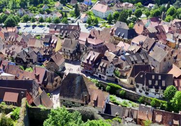
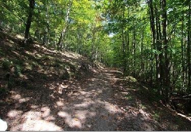
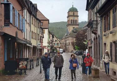
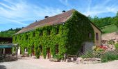
Jalon illuminé sur la route des Vins, Kaysersberg surprend par le charme de ses sites médiévaux groupés autour de l’église (portail roman et au retable sculpté, chef d’œuvre rarement égalé) et du pont fortifié dominé par le château (vestige de l’ancienne ville libre de la décapole). Sa position stratégique ranime le souvenir de la route Romaine qui reliait l’Alsace à la Lorraine. C’est une des plus charmantes cités d’Alsace avec ses ruelles pavées et ses maisons à colombages richement ornées. Son hôtellerie accueillante offre de quoi satisfaire le plus exigeant. De plus, la ville natale du docteur Schweitzer se signale par ses possibilités de camping et l’agrément de ses promenades forestières dans un calme absolu. Située sur la route de St Jacques de Compostelle. Auberge Saint-Alexis : Au pied du Seelbourg et du Koenigstuhl, à une altitude de 650 mètres s'élèvent une ancienne ferme et une petite chapelle. Lieu de randonnée privilégié, cet endroit idyllique attire chaque année de nombreux promeneurs prêts à découvrir les beautés et la majesté de sites et de forêts. Depuis 1930, la famille Barlier-Ertlé exploite l'auberge. Départ : Office du Tourisme de Kaysersberg. Balisage : Croix bleu – disque jaune.

Elevation profile

Photos

Points of interest

Point of interest Kaysersberg-Vignoble - 001 - Photo
tracegps
KAYSERSBERG-VIGNOBLE 
Point of interest Kaysersberg-Vignoble - 002 - Photo
tracegps
KAYSERSBERG-VIGNOBLE 
Point of interest Kaysersberg-Vignoble - 003 - Photo
tracegps
KAYSERSBERG-VIGNOBLE 
Point of interest Kaysersberg-Vignoble - 004 - Photo
tracegps
KAYSERSBERG-VIGNOBLE 
Point of interest Kaysersberg-Vignoble - 005 - Photo
tracegps
KAYSERSBERG-VIGNOBLE 
Point of interest Kaysersberg-Vignoble - 006 - Photo
tracegps
KAYSERSBERG-VIGNOBLE 
Point of interest Riquewihr - 008 - Photo
tracegps
RIQUEWIHR 
Point of interest Kaysersberg-Vignoble - 009 - Photo
tracegps
KAYSERSBERG-VIGNOBLE 
Point of interest Kaysersberg-Vignoble - 010 - Photo
tracegps
KAYSERSBERG-VIGNOBLE 
Point of interest Kaysersberg-Vignoble - 012 - Photo
tracegps
KAYSERSBERG-VIGNOBLE 
Point of interest Kaysersberg-Vignoble - 013 - Photo
tracegps
KAYSERSBERG-VIGNOBLE 
Point of interest Kaysersberg-Vignoble - 014 - Photo
tracegps
KAYSERSBERG-VIGNOBLE 
Point of interest Kaysersberg-Vignoble - 015 - Photo
tracegps
KAYSERSBERG-VIGNOBLE 
Point of interest Kaysersberg-Vignoble - 016 - Photo
tracegps
KAYSERSBERG-VIGNOBLE 

Positioning

Country:
France
Region :
Grand Est
Department/Province :
Haut-Rhin
Municipality :
Kaysersberg-Vignoble
Location:
Unknown
Start:(UTM)
371002 ; 5333148 (32U) N.

Trails nearby

Trail Walking Ammerschwihr - D'Ammerschwihr aux Trois Epis - Photo
Walking
VacheKiri67

Walking

Difficult
(1)
Ammerschwihr, Grand Est, Haut-Rhin, France
17.1 km | 25 km-effort
5h 35min
Yes
Trail Walking Ammerschwihr - Trois Épis le rocher du corbeau  - Photo
Walking
zazie

Walking

Easy
(2)
Ammerschwihr, Grand Est, Haut-Rhin, France
4.4 km | 5.7 km-effort
59min
Yes
Trail Walking Kaysersberg-Vignoble - 2021-05-30 Marche Kaysersberg Ursprung St Alexis - Photo
Walking
GUIDE
holtzv

Walking

Very difficult
Kaysersberg-Vignoble, Grand Est, Haut-Rhin, France
17.1 km | 26 km-effort
4h 46min
Yes
Trail Horseback riding Kaysersberg-Vignoble - 2019-10-26 CDTE67 Tournage Video Promotion TE - Photo
Horseback riding
GUIDE
holtzv

Horseback riding

Easy
Kaysersberg-Vignoble, Grand Est, Haut-Rhin, France
24 km | 29 km-effort
24min
No
Trail Walking Hunawihr - Hunawihr - Riquewihr - Photo
Walking
JMCMoreau

Walking

Easy
(1)
Hunawihr, Grand Est, Haut-Rhin, France
6.3 km | 9 km-effort
2h 15min
Yes
Trail Horseback riding Kaysersberg-Vignoble - 000004 - Photo
Horseback riding
GUIDE
holtzv

Horseback riding

Very difficult
Kaysersberg-Vignoble, Grand Est, Haut-Rhin, France
32 km | 45 km-effort
5h 55min
Yes
Trail Walking Riquewihr - Sentier des grands crus - Photo
Walking
GUIDE
pascalou73

Walking

Medium
(2)
Riquewihr, Grand Est, Haut-Rhin, France
11.5 km | 14.4 km-effort
3h 7min
Yes
Trail Walking Kaysersberg-Vignoble - Le tour de Kysersberg - Photo
Walking
GUIDE
pascalou73

Walking

Medium
(1)
Kaysersberg-Vignoble, Grand Est, Haut-Rhin, France
7.9 km | 11.7 km-effort
2h 34min
Yes
Trail Walking Katzenthal - Katzenthal  - Photo
Walking
2433e59

Walking

Difficult
Katzenthal, Grand Est, Haut-Rhin, France
16.4 km | 25 km-effort
5h 40min
Yes


Close
My subscriptions