


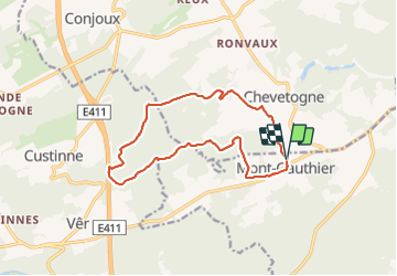
190325 Mont Gauthier

guy284
User

Length
12.8 km

Max alt
309 m

Uphill gradient
244 m
Km-Effort
16.1 km

Min alt
199 m

Downhill gradient
249 m
Boucle
Yes
Creation date :
2019-05-06 23:17:55.444
Updated on :
2019-05-06 23:17:55.444
2h40
Difficulty : Unknown

FREE GPS app for hiking
 SityTrail
IGN / Geographical institutes
SityTrail Plus
The world is yours!
About
Trail Other activity of 12.8 km to be discovered at Wallonia, Namur, Rochefort. This trail is proposed by guy284.
Description
Ce parcours emprunte un chemin privé traversant la ''donation royale''. Autorisation préalable nécessaire.
Positioning
Country:
Belgium
Region :
Wallonia
Department/Province :
Namur
Municipality :
Rochefort
Location:
Mont-Gauthier
Start:(Dec)
Start:(UTM)
651349 ; 5564230 (31U) N.
Comments