Trail Walking Benerville-sur-Mer - Sentier nature du Mont Canisy - Photo

Sentier nature du Mont Canisy

© OpenStreetMap contributors
Length
Length
2.4 km
Max alt
Max alt
110 m
Uphill gradient
Uphill gradient
41 m
Km-Effort
Km-Effort  
3 km
Min alt
Min alt
78 m
Downhill gradient
Downhill gradient
41 m
Boucle
Boucle
Yes
Creation date :
2019-04-02 12:16:44.484
Updated on :
2019-04-02 12:16:44.484

(0 Reviews)

Walking
Walking
40m
Difficulty : Easy

Scan this QR Code to open this trail in the SityTrail application

FREE GPS app for hiking

Logo SityTrail SityTrail

IGN / Geographical institutes

Download SityTrail from the App Store Download SityTrail from Google Play

Logo SityTrail SityTrail World

The world is yours!

Download SityTrail from the App Store Download SityTrail from Google Play Download SityTrail on Huawei AppGallery

About

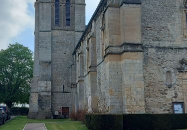
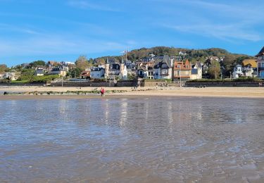
Trail Walking of 2.4 km to be discovered at Normandy, Calvados, Benerville-sur-Mer. This trail is proposed by neoroll44.

Description

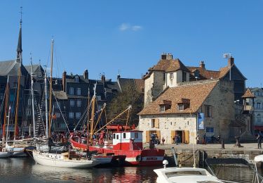
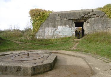
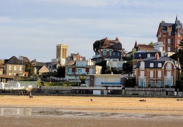
Le site offre quelques points de vues exceptionnels sur les marais de la Touques, les collines augeronnes, les falaises des Vaches Noires et sur la Côte Fleurie. Riche d'une faune et d'une flore propres aux pelouses calcicoles, il possède également d'importants vestiges du Mur de l'Atlantique.
1. Entrée route de Canisy, à Bénerville-sur-Mer. Rentrer sur le site par la barrière en métal. Passage piéton sur le côté gauche de la barrière.
2. Monter 300 m par la voie goudronnée. Arrivée au « Belvédère », drapeau vert et bleu (profiter de la vue sur le marais de Blonville-Villers).
3. Traverser la plate-forme enherbée et prendre le chemin en terre et cailloux en face de la montée. Suivre le chemin sur 250 m jusqu’au point de vue sur la « côte Fleurie » (le chemin est sinueux).
4. Continuer ce chemin sur encore 200 m. Vous voyez les casemates (gros blockhaus). Ne pas continuer mais prendre le chemin qui part sur la gauche.
5. Suivre ce chemin (ne jamais prendre à gauche). Au bout de 180 m, prendre le chemin qui part sur la droite sous la voute couverte. Faire 150 m pour déboucher sur un grand chemin empierré.
6. Prendre à droite toujours tout droit sur 450 m. Vous passez entre les casemates puis à côté du poste de commandement (sur votre gauche). Passé le poste ne pas prendre à droite mais rester sur le chemin de gauche. Vous débouchez sur chemin bordé de grands cyprès.
7. Prendre à gauche sur près de 200 m. Passé les blocs rocheux, emprunter le chemin de gauche qui rentre dans la forêt par les marches en bois. Suivre le chemin, toujours dans la forêt, sur 400 m. Vous débouchez sur un chemin qui monte sur la gauche et qui descend sur la droite.
8. Prendre à droite. Faites 50 m et vous revenez sur le bord de route où votre véhicule est stationné.

Elevation profile

Points of interest

Point of interest Benerville-sur-Mer - 1 - Photo
neoroll44
BENERVILLE-SUR-MER 
Point of interest Benerville-sur-Mer - 2 - Photo
neoroll44
BENERVILLE-SUR-MER 
Point of interest Benerville-sur-Mer - 3 - Photo
neoroll44
BENERVILLE-SUR-MER 
Point of interest Benerville-sur-Mer - 4 - Photo
neoroll44
BENERVILLE-SUR-MER 
Point of interest Benerville-sur-Mer - 5 - Photo
neoroll44
BENERVILLE-SUR-MER 
Point of interest Benerville-sur-Mer - 6 - Photo
neoroll44
BENERVILLE-SUR-MER 
Point of interest Benerville-sur-Mer - 7 - Photo
neoroll44
BENERVILLE-SUR-MER 
Point of interest Benerville-sur-Mer - 8 - Photo
neoroll44
BENERVILLE-SUR-MER 

Positioning

Country:
France
Region :
Normandy
Department/Province :
Calvados
Municipality :
Benerville-sur-Mer
Location:
Unknown
Start:(UTM)
285180 ; 5469743 (31U) N.

Trails nearby

Trail Walking Blonville-sur-Mer - Blonville 2 - Photo
Walking
phi14

Walking

Very easy
(1)
Blonville-sur-Mer, Normandy, Calvados, France
8.3 km | 10.1 km-effort
2h 11min
Yes
Trail Walking Villers-sur-Mer - Villers Sur mer  - Photo
Walking
phi14

Walking

Very easy
(1)
Villers-sur-Mer, Normandy, Calvados, France
9.7 km | 10.9 km-effort
2h 35min
Yes
Trail Walking Deauville - Deauville Touques - Photo
Walking
Axelloceane

Walking

Easy
Deauville, Normandy, Calvados, France
9.4 km | 10.4 km-effort
2h 13min
Yes
Trail Walking Deauville - Deauville Honfleur - Photo
Walking
Axelloceane

Walking

Medium
Deauville, Normandy, Calvados, France
26 km | 32 km-effort
5h 40min
No
Trail Walking Blonville-sur-Mer - Entre marais et histoire - Photo
Walking
rigol05

Walking

Easy
Blonville-sur-Mer, Normandy, Calvados, France
11.1 km | 13 km-effort
2h 44min
Yes
Trail Nordic walking Villers-sur-Mer - Marche nordique à Villers - Photo
Nordic walking
chessyca

Nordic walking

Very easy
Villers-sur-Mer, Normandy, Calvados, France
8.3 km | 8.4 km-effort
Unknown
Yes
Trail Walking Tourgéville - Combo rando et marche nordique à Deauville - Photo
Walking
chessyca

Walking

Very easy
Tourgéville, Normandy, Calvados, France
20 km | 22 km-effort
4h 12min
Yes
Trail Walking Tourgéville - CRAB : Tourgéville - Deauville - Photo
Walking
PatRando

Walking

Medium
Tourgéville, Normandy, Calvados, France
18 km | 22 km-effort
3h 48min
Yes
Trail Walking Villers-sur-Mer - promenade familiale. les falaises des vaches noires entre Villers-sur-Mer et Houlgate. A faire à marée basse. - Photo
Walking
wallander76

Walking

Very easy
(1)
Villers-sur-Mer, Normandy, Calvados, France
7.9 km | 8.5 km-effort
1h 53min
Yes


Close
My subscriptions