


les 3 croix by phiphidechagny

phiphidechagny
User

Length
31 km

Max alt
514 m

Uphill gradient
616 m
Km-Effort
39 km

Min alt
204 m

Downhill gradient
616 m
Boucle
Yes
Creation date :
2019-05-06 23:44:38.945
Updated on :
2019-05-06 23:44:38.945
3h11
Difficulty : Medium

FREE GPS app for hiking
 SityTrail
IGN / Geographical institutes
SityTrail Plus
The world is yours!
About
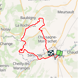
Trail Mountain bike of 31 km to be discovered at Bourgogne-Franche-Comté, Saône-et-Loire, Chagny. This trail is proposed by phiphidechagny.
Description
Montee aux 3 croix par St Jean et retour par La Rochepot St Aubin, Chassagne Montrachet
Positioning
Country:
France
Region :
Bourgogne-Franche-Comté
Department/Province :
Saône-et-Loire
Municipality :
Chagny
Location:
Unknown
Start:(Dec)
Start:(UTM)
632919 ; 5196011 (31T) N.
Comments