


Zevtt - Transvienne 2010

kipoura
User
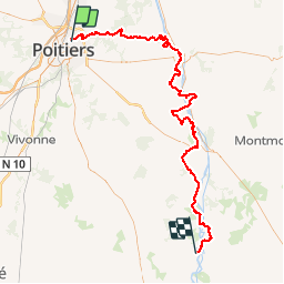

Length
102 km

Max alt
182 m

Uphill gradient
1315 m
Km-Effort
119 km

Min alt
59 m

Downhill gradient
1297 m
Boucle
No
Creation date :
2019-05-03 17:11:11.025
Updated on :
2019-05-03 17:11:11.155
6h00
Difficulty : Medium

FREE GPS app for hiking
 SityTrail
IGN / Geographical institutes
SityTrail Plus
The world is yours!
About
Trail Mountain bike of 102 km to be discovered at New Aquitaine, Vienne, Buxerolles. This trail is proposed by kipoura.
Description
Allez un petit 100 kilométres histoire de se mettre en jambe .... http://zevtt.free.fr
Positioning
Country:
France
Region :
New Aquitaine
Department/Province :
Vienne
Municipality :
Buxerolles
Location:
Unknown
Start:(Dec)
Start:(UTM)
298055 ; 5163564 (31T) N.
Comments