


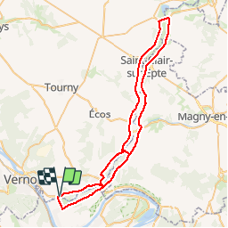
Giverny- vallée de l'epte

fredtruc27
User

Length
69 km

Max alt
59 m

Uphill gradient
533 m
Km-Effort
76 km

Min alt
12 m

Downhill gradient
534 m
Boucle
Yes
Creation date :
2019-05-07 00:44:22.96
Updated on :
2019-05-07 00:44:22.96
2h48
Difficulty : Easy

FREE GPS app for hiking
 SityTrail
IGN / Geographical institutes
SityTrail Plus
The world is yours!
About
Trail Cycle of 69 km to be discovered at Normandy, Eure, Giverny. This trail is proposed by fredtruc27.
Positioning
Country:
France
Region :
Normandy
Department/Province :
Eure
Municipality :
Giverny
Location:
Unknown
Start:(Dec)
Start:(UTM)
393719 ; 5436741 (31U) N.
Comments