


Saint-Nicolas de Bliquetuit (Vers l'Armada)

MichelRando7656
User

Length
11.2 km

Max alt
16 m

Uphill gradient
72 m
Km-Effort
12.2 km

Min alt
0 m

Downhill gradient
70 m
Boucle
Yes
Creation date :
2019-04-29 10:39:14.622
Updated on :
2019-04-29 10:39:14.745
2h32
Difficulty : Unknown

FREE GPS app for hiking
 SityTrail
IGN / Geographical institutes
SityTrail Plus
The world is yours!
About
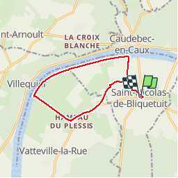
Trail Walking of 11.2 km to be discovered at Normandy, Seine-Maritime, Arelaune-en-Seine. This trail is proposed by MichelRando7656.
Description
Circuit vers la Seine -Circuit à inverser
Photos
 - Photo 1")
 - Photo 2")
 - Photo 3")
 - Photo 4")
 - Photo 5")
 - Photo 6")
Positioning
Country:
France
Region :
Normandy
Department/Province :
Seine-Maritime
Municipality :
Arelaune-en-Seine
Location:
Unknown
Start:(Dec)
Start:(UTM)
335572 ; 5486398 (31U) N.
Comments