


la citadelle de buron

jeanic63
User
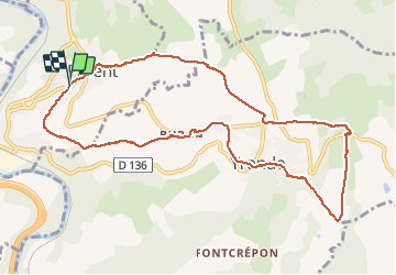

Length
11.2 km

Max alt
689 m

Uphill gradient
349 m
Km-Effort
15.9 km

Min alt
447 m

Downhill gradient
350 m
Boucle
Yes
Creation date :
2019-05-07 01:13:19.38
Updated on :
2021-04-11 09:36:54.071
3h04
Difficulty : Unknown

FREE GPS app for hiking
 SityTrail
IGN / Geographical institutes
SityTrail Plus
The world is yours!
About
Trail Other activity of 11.2 km to be discovered at Auvergne-Rhône-Alpes, Puy-de-Dôme, Parent. This trail is proposed by jeanic63.
Description
départ parent parking face au village vacances
Positioning
Country:
France
Region :
Auvergne-Rhône-Alpes
Department/Province :
Puy-de-Dôme
Municipality :
Parent
Location:
Unknown
Start:(Dec)
Start:(UTM)
517609 ; 5052019 (31T) N.
Comments