Bussières Esserteaux Roc Vergisson

janussity
User
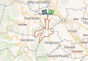

Length
11.7 km

Max alt
550 m

Uphill gradient
389 m
Km-Effort
16.9 km

Min alt
232 m

Downhill gradient
389 m
Boucle
Yes
Creation date :
2019-05-07 01:42:09.851
Updated on :
2019-05-07 01:42:09.851
2h39
Difficulty : Medium

FREE GPS app for hiking
 SityTrail
IGN / Geographical institutes
SityTrail Plus
The world is yours!
About
Trail Walking of 11.7 km to be discovered at Bourgogne-Franche-Comté, Saône-et-Loire, Bussières. This trail is proposed by janussity.
Description
ensoleillé 11,5 km
Positioning
Country:
France
Region :
Bourgogne-Franche-Comté
Department/Province :
Saône-et-Loire
Municipality :
Bussières
Location:
Unknown
Start:(Dec)
Start:(UTM)
631610 ; 5132611 (31T) N.
Comments