


CARANCA2018

UDGI54
User

Length
24 km

Max alt
1272 m

Uphill gradient
2688 m
Km-Effort
60 km

Min alt
680 m

Downhill gradient
2674 m
Boucle
No
Creation date :
2019-05-07 03:04:33.851
Updated on :
2019-05-07 03:04:33.851
--
Difficulty : Unknown

FREE GPS app for hiking
 SityTrail
IGN / Geographical institutes
SityTrail Plus
The world is yours!
About
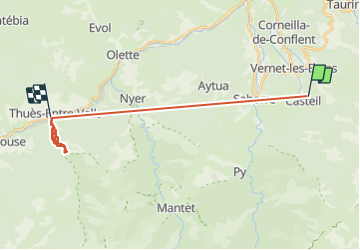
Trail Walking of 24 km to be discovered at Occitania, Pyrénées-Orientales, Casteil. This trail is proposed by UDGI54.
Positioning
Country:
France
Region :
Occitania
Department/Province :
Pyrénées-Orientales
Municipality :
Casteil
Location:
Unknown
Start:(Dec)
Start:(UTM)
450536 ; 4709187 (31T) N.
Comments