


Hastiere 03.05.2019

fra_depoorter
User
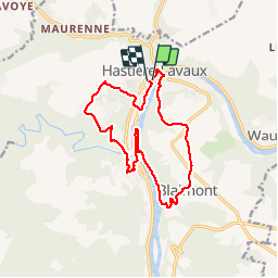

Length
13.7 km

Max alt
243 m

Uphill gradient
368 m
Km-Effort
18.6 km

Min alt
92 m

Downhill gradient
371 m
Boucle
Yes
Creation date :
2019-05-07 03:25:09.377
Updated on :
2019-05-07 03:25:09.377
3h10
Difficulty : Unknown

FREE GPS app for hiking
 SityTrail
IGN / Geographical institutes
SityTrail Plus
The world is yours!
About
Trail Walking of 13.7 km to be discovered at Wallonia, Namur, Hastière. This trail is proposed by fra_depoorter.
Positioning
Country:
Belgium
Region :
Wallonia
Department/Province :
Namur
Municipality :
Hastière
Location:
Hastière-Lavaux
Start:(Dec)
Start:(UTM)
630115 ; 5564074 (31U) N.
Comments