


bevy

phil21
User
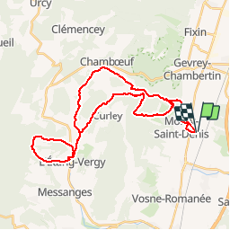

Length
35 km

Max alt
481 m

Uphill gradient
655 m
Km-Effort
44 km

Min alt
238 m

Downhill gradient
654 m
Boucle
Yes
Creation date :
2014-12-10 00:00:00.0
Updated on :
2014-12-10 00:00:00.0
2h54
Difficulty : Difficult

FREE GPS app for hiking
 SityTrail
IGN / Geographical institutes
SityTrail Plus
The world is yours!
About
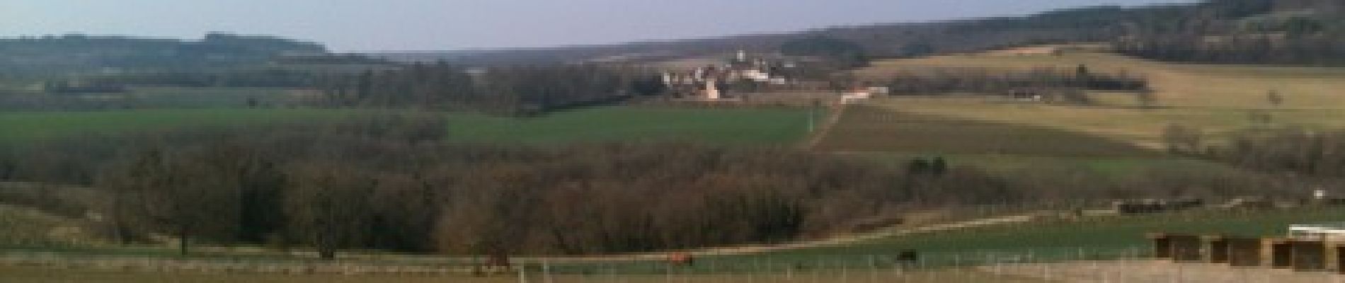
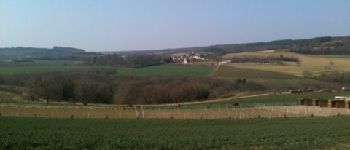
Trail Mountain bike of 35 km to be discovered at Bourgogne-Franche-Comté, Côte-d'Or, Morey-Saint-Denis. This trail is proposed by phil21.
Photos


Positioning
Country:
France
Region :
Bourgogne-Franche-Comté
Department/Province :
Côte-d'Or
Municipality :
Morey-Saint-Denis
Location:
Unknown
Start:(Dec)
Start:(UTM)
649550 ; 5228536 (31T) N.
Comments