


sentier forêt de chai l'élue

raab
User

Length
8.7 km

Max alt
371 m

Uphill gradient
137 m
Km-Effort
10.5 km

Min alt
330 m

Downhill gradient
141 m
Boucle
Yes
Creation date :
2018-07-30 16:23:40.675
Updated on :
2018-07-30 16:23:40.747
2h24
Difficulty : Very easy

FREE GPS app for hiking
 SityTrail
IGN / Geographical institutes
SityTrail Plus
The world is yours!
About
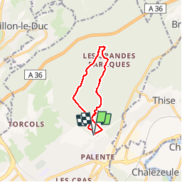
Trail Walking of 8.7 km to be discovered at Bourgogne-Franche-Comté, Doubs, Besançon. This trail is proposed by raab.
Positioning
Country:
France
Region :
Bourgogne-Franche-Comté
Department/Province :
Doubs
Municipality :
Besançon
Location:
Unknown
Start:(Dec)
Start:(UTM)
276519 ; 5239693 (32T) N.
Comments