


Zevtt - Lavausseau 2012

kipoura
User
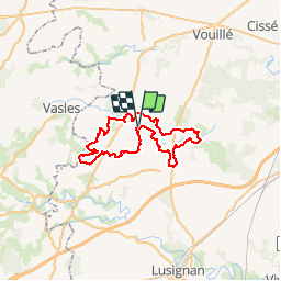

Length
48 km

Max alt
183 m

Uphill gradient
448 m
Km-Effort
53 km

Min alt
109 m

Downhill gradient
451 m
Boucle
Yes
Creation date :
2019-05-03 17:10:38.477
Updated on :
2019-05-03 17:10:38.554
2h30
Difficulty : Medium

FREE GPS app for hiking
 SityTrail
IGN / Geographical institutes
SityTrail Plus
The world is yours!
About
Trail Mountain bike of 48 km to be discovered at New Aquitaine, Vienne, Boivre-la-Vallée. This trail is proposed by kipoura.
Description
Une trace GPS reprenant le parcours de la randonnée VTT de Lavausseau 2012. Un circuit typé roulant avec de beau passages ludiques et quelques belles grimpettes ..... http://zevtt.free.fr
Positioning
Country:
France
Region :
New Aquitaine
Department/Province :
Vienne
Municipality :
Boivre-la-Vallée
Location:
Unknown
Start:(Dec)
Start:(UTM)
275714 ; 5160288 (31T) N.
Comments