


Dormillouse direct Pré la Pierre

saintherant
User
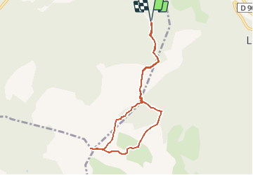

Length
7.8 km

Max alt
2490 m

Uphill gradient
1082 m
Km-Effort
22 km

Min alt
1420 m

Downhill gradient
1080 m
Boucle
Yes
Creation date :
2014-12-10 00:00:00.0
Updated on :
2014-12-10 00:00:00.0
--
Difficulty : Difficult

FREE GPS app for hiking
 SityTrail
IGN / Geographical institutes
SityTrail Plus
The world is yours!
About
Trail Walking of 7.8 km to be discovered at Provence-Alpes-Côte d'Azur, Alpes-de-Haute-Provence, Ubaye-Serre-Ponçon. This trail is proposed by saintherant.
Positioning
Country:
France
Region :
Provence-Alpes-Côte d'Azur
Department/Province :
Alpes-de-Haute-Provence
Municipality :
Ubaye-Serre-Ponçon
Location:
Saint-Vincent-les-Forts
Start:(Dec)
Start:(UTM)
293137 ; 4923142 (32T) N.
Comments