


GLM-120509 - Apremont

randodan
User
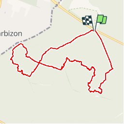

Length
10.1 km

Max alt
137 m

Uphill gradient
151 m
Km-Effort
12.1 km

Min alt
84 m

Downhill gradient
153 m
Boucle
Yes
Creation date :
2014-12-10 00:00:00.0
Updated on :
2014-12-10 00:00:00.0
--
Difficulty : Medium

FREE GPS app for hiking
 SityTrail
IGN / Geographical institutes
SityTrail Plus
The world is yours!
About
Trail Walking of 10.1 km to be discovered at Ile-de-France, Seine-et-Marne, Fontainebleau. This trail is proposed by randodan.
Description
Les Gais Lurons du Mercredi
9 mai 2012
Cfr Epine - Apremont
par le circuit Erosion, Mare aux Biches, Caverne Brigands, Dormoire, Stèle Millet-Rousseau, Ventes Alexandre.
Positioning
Country:
France
Region :
Ile-de-France
Department/Province :
Seine-et-Marne
Municipality :
Fontainebleau
Location:
Unknown
Start:(Dec)
Start:(UTM)
473211 ; 5365868 (31U) N.
Comments