


Donjon

Jeff_314
User
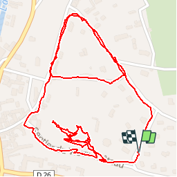

Length
2.1 km

Max alt
107 m

Uphill gradient
62 m
Km-Effort
2.9 km

Min alt
69 m

Downhill gradient
57 m
Boucle
Yes
Creation date :
2014-12-10 00:00:00.0
Updated on :
2014-12-10 00:00:00.0
1h01
Difficulty : Very easy

FREE GPS app for hiking
 SityTrail
IGN / Geographical institutes
SityTrail Plus
The world is yours!
About
Trail Walking of 2.1 km to be discovered at Normandy, Eure, Brionne. This trail is proposed by Jeff_314.
Positioning
Country:
France
Region :
Normandy
Department/Province :
Eure
Municipality :
Brionne
Location:
Unknown
Start:(Dec)
Start:(UTM)
334254 ; 5451618 (31U) N.
Comments