


Vallée de la Souleuvre

phi14
User

Length
10.6 km

Max alt
186 m

Uphill gradient
200 m
Km-Effort
13.3 km

Min alt
72 m

Downhill gradient
204 m
Boucle
Yes
Creation date :
2014-12-10 00:00:00.0
Updated on :
2014-12-10 00:00:00.0
2h53
Difficulty : Easy

FREE GPS app for hiking
 SityTrail
IGN / Geographical institutes
SityTrail Plus
The world is yours!
About
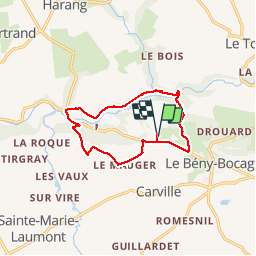
Trail Walking of 10.6 km to be discovered at Normandy, Calvados, Souleuvre-en-Bocage. This trail is proposed by phi14.


Positioning
Country:
France
Region :
Normandy
Department/Province :
Calvados
Municipality :
Souleuvre-en-Bocage
Location:
Carville
Start:(Dec)
Start:(UTM)
656842 ; 5423317 (30U) N.
Comments