


GLM-120530 - CanonEvées

randodan
User
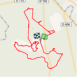

Length
15.2 km

Max alt
138 m

Uphill gradient
163 m
Km-Effort
17.4 km

Min alt
81 m

Downhill gradient
165 m
Boucle
Yes
Creation date :
2014-12-10 00:00:00.0
Updated on :
2014-12-10 00:00:00.0
6h09
Difficulty : Easy

FREE GPS app for hiking
 SityTrail
IGN / Geographical institutes
SityTrail Plus
The world is yours!
About
Trail Walking of 15.2 km to be discovered at Ile-de-France, Seine-et-Marne, Fontainebleau. This trail is proposed by randodan.
Description
Gais Lurons du Mercredi
30 mai 2012
départ parking Canon, Table du Grand Maître, Rte Tournante Longues Vallées, Rocher Canon, Mare aux Evées, Mare aux Cerfs
Positioning
Country:
France
Region :
Ile-de-France
Department/Province :
Seine-et-Marne
Municipality :
Fontainebleau
Location:
Unknown
Start:(Dec)
Start:(UTM)
475259 ; 5367785 (31U) N.
Comments