


Vernot Val Suzon St.Seine Lamargelle Vernot

alexbnmr
User
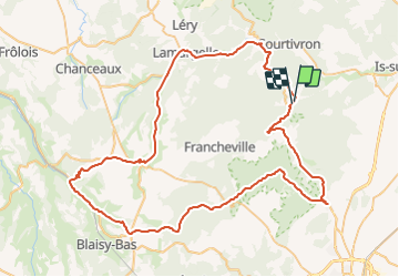

Length
85 km

Max alt
565 m

Uphill gradient
1191 m
Km-Effort
101 km

Min alt
292 m

Downhill gradient
1191 m
Boucle
Yes
Creation date :
2014-12-10 00:00:00.0
Updated on :
2014-12-10 00:00:00.0
--
Difficulty : Medium

FREE GPS app for hiking
 SityTrail
IGN / Geographical institutes
SityTrail Plus
The world is yours!
About
Trail Cycle of 85 km to be discovered at Bourgogne-Franche-Comté, Côte-d'Or, Vernot. This trail is proposed by alexbnmr.


Positioning
Country:
France
Region :
Bourgogne-Franche-Comté
Department/Province :
Côte-d'Or
Municipality :
Vernot
Location:
Unknown
Start:(Dec)
Start:(UTM)
648700 ; 5261705 (31T) N.
Comments