Trail Walking Metz - Circuit des remparts à Metz - Photo

Circuit des remparts à Metz

© OpenStreetMap contributors
Length
Length
3.7 km
Max alt
Max alt
210 m
Uphill gradient
Uphill gradient
57 m
Km-Effort
Km-Effort  
4.5 km
Min alt
Min alt
163 m
Downhill gradient
Downhill gradient
57 m
Boucle
Boucle
Yes
Creation date :
2014-12-10 00:00:00.0
Updated on :
2014-12-10 00:00:00.0

(0 Reviews)

Walking
Walking
--
Difficulty : Easy

Scan this QR Code to open this trail in the SityTrail application

FREE GPS app for hiking

Logo SityTrail SityTrail

IGN / Geographical institutes

Download SityTrail from the App Store Download SityTrail from Google Play

Logo SityTrail SityTrail Plus

The world is yours!

Download SityTrail from the App Store Download SityTrail from Google Play Download SityTrail on Huawei AppGallery

About

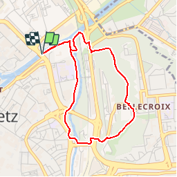
Trail Walking of 3.7 km to be discovered at Grand Est, Moselle, Metz. This trail is proposed by edmondnagel.

Description

Depuis le pont des Grilles jusqu’à la Porte des Allemands, vous circulerez entre et le long des remparts des 13e et 15e siècles, et, en rive droite de la Seille, vous pourrez admirer les remparts du 17e siècle.
Enfin, vous accèderez au Fort de Bellecroix et découvrirez ses fortifications des 18e et 19e siècle.

Elevation profile

Positioning

Country:
France
Region :
Grand Est
Department/Province :
Moselle
Municipality :
Metz
Location:
Unknown
Start:(UTM)
294392 ; 5445147 (32U) N.


Close
My subscriptions