


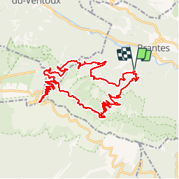
Ventoux depuis Brantes

MarcLEBARON
User

Length
27 km

Max alt
1907 m

Uphill gradient
1448 m
Km-Effort
46 km

Min alt
587 m

Downhill gradient
1449 m
Boucle
Yes
Creation date :
2014-12-10 00:00:00.0
Updated on :
2014-12-10 00:00:00.0
7h20
Difficulty : Difficult

FREE GPS app for hiking
 SityTrail
IGN / Geographical institutes
SityTrail Plus
The world is yours!
About
Trail Walking of 27 km to be discovered at Provence-Alpes-Côte d'Azur, Vaucluse, Brantes. This trail is proposed by MarcLEBARON.
Description
boucle
Positioning
Country:
France
Region :
Provence-Alpes-Côte d'Azur
Department/Province :
Vaucluse
Municipality :
Brantes
Location:
Unknown
Start:(Dec)
Start:(UTM)
685759 ; 4895070 (31T) N.
Comments