![](/images/other/stat-length.png)
![Trail Cycle Durbuy - La Dorsale - Photo](https://media.geolcdn.com/t/1900/400/ext.pjpeg?maxdim=2&url=https%3A%2F%2Fservices.sitytrail.com%2FGeolivesWS%2FDownloadMedia.ashx%3FTrailID%3D134518%26Media%3D8b61ae87-28f8-4309-9600-f96566c94252.jpg)
La Dorsale
Pays de Famenne à vélo
Randonnées du Pays de Famenne à vélo GUIDE+
![Length](/images/other/stat-length.png)
Length
75 km
![Max alt](https://static1.geolcdn.com/siteimages/upload/files/1508320355ic_sort_altitude_max_24dp.png)
Max alt
311 m
![Uphill gradient](https://static1.geolcdn.com/siteimages/upload/files/1508320355ic_sort_den_pos_24dp.png)
Uphill gradient
843 m
![Km-Effort](/images/other/stat-length.png)
Km-Effort
87 km
![Min alt](https://static1.geolcdn.com/siteimages/upload/files/1508320355ic_sort_altitude_min_24dp.png)
Min alt
117 m
![Downhill gradient](https://static1.geolcdn.com/siteimages/upload/files/1508320355ic_sort_den_neg_24dp.png)
Downhill gradient
867 m
![Boucle](https://static1.geolcdn.com/siteimages/upload/files/16400158638029165_repeat_loop_refresh_sync_direction_icon.png)
Boucle
No
Creation date :
2015-07-08 00:00:00.0
Updated on :
2015-07-08 00:00:00.0
![Cycle](https://static1.geolcdn.com/sitytour/trail-icons/200.png)
4h56
Difficulty : Easy
![Scan this QR Code to open this trail in the SityTrail application](https://capi.geolives.com/qq0zvz2zws4bq2lad0pu/sitytour/trails/134518/qr.png?size=200)
FREE GPS app for hiking
About
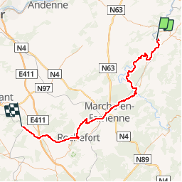
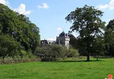
Trail Cycle of 75 km to be discovered at Wallonia, Luxembourg, Durbuy. This trail is proposed by Pays de Famenne à vélo.
Description
From Houyet to Bomal
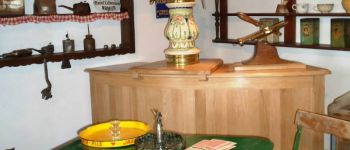
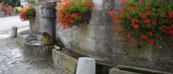
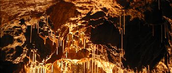
Points of interest
Positioning
Country:
Belgium
Region :
Wallonia
Department/Province :
Luxembourg
Municipality :
Durbuy
Location:
Tohogne
Start:(Dec)
Start:(UTM)
679461 ; 5586333 (31U) N.
Comments
Trails nearby
![Trail Walking Hamoir - RB-Lg-19_Hamoir - Photo](https://media.geolcdn.com/t/375/260/ext.jpg?maxdim=2&url=https%3A%2F%2Fservices.sitytrail.com%2FGeolivesWS%2FDownloadMedia.ashx%3FTrailID%3D400602%26Media%3Dc0745639-8ded-479e-9345-a8c68cd61e6a.jpg)
![Walking Walking](https://static1.geolcdn.com/sitytour/trail-icons/101.png)
RB-Lg-19_Hamoir
Walking
Very difficult
(6)
Hamoir,
Wallonia,
Liège,
Belgium
![](/images/other/stat-length.png)
22 km | 28 km-effort
6h 18min
![](https://static1.geolcdn.com/siteimages/upload/files/16400158638029165_repeat_loop_refresh_sync_direction_icon.png)
Yes
![Trail Walking Durbuy - RB-Lu-01 - Un petit bout de Condroz - Photo](https://media.geolcdn.com/t/375/260/ext.jpg?maxdim=2&url=https%3A%2F%2Fservices.sitytrail.com%2FGeolivesWS%2FDownloadMedia.ashx%3FTrailID%3D179610%26Media%3Dbae66ec4-955f-4295-8f2d-e1b21fcea213.jpg)
![Walking Walking](https://static1.geolcdn.com/sitytour/trail-icons/101.png)
RB-Lu-01 - Un petit bout de Condroz
Walking
Difficult
(5)
Durbuy,
Wallonia,
Luxembourg,
Belgium
![](/images/other/stat-length.png)
24 km | 30 km-effort
6h 27min
![](https://static1.geolcdn.com/siteimages/upload/files/16400158638029165_repeat_loop_refresh_sync_direction_icon.png)
Yes
![Trail Walking Durbuy - Balade à Bomal sur Ourthe - Photo](https://media.geolcdn.com/t/375/260/ext.jpg?maxdim=2&url=https%3A%2F%2Fmedia.geolcdn.com%2Ff%2F5741dd62-7ff1-40d2-b9aa-0e0aed97da9a.jpg)
![Walking Walking](https://static1.geolcdn.com/sitytour/trail-icons/101.png)
Balade à Bomal sur Ourthe
Walking
Easy
(2)
Durbuy,
Wallonia,
Luxembourg,
Belgium
![](/images/other/stat-length.png)
4.4 km | 5.9 km-effort
1h 20min
![](https://static1.geolcdn.com/siteimages/upload/files/16400158638029165_repeat_loop_refresh_sync_direction_icon.png)
Yes
![Trail Walking Ferrières - GG-Lu-15_Sy - Barvaux - Photo](https://media.geolcdn.com/t/375/260/ext.jpg?maxdim=2&url=https%3A%2F%2Fmedia.geolcdn.com%2Ff%2F4cf6fb9a-77d5-4c51-bb72-4b6ca6a27202.jpg)
![Walking Walking](https://static1.geolcdn.com/sitytour/trail-icons/101.png)
GG-Lu-15_Sy - Barvaux
Walking
Very difficult
(1)
Ferrières,
Wallonia,
Liège,
Belgium
![](/images/other/stat-length.png)
18.9 km | 26 km-effort
5h 58min
![](https://static1.geolcdn.com/siteimages/upload/files/16400158638029165_repeat_loop_refresh_sync_direction_icon.png)
No
![Trail Walking Durbuy - GG2-Lu-36_Bomal-Marloie (2021-11-04) - Photo](https://media.geolcdn.com/t/375/260/ext.jpg?maxdim=2&url=https%3A%2F%2Fmedia.geolcdn.com%2Ff%2F17057bf6-1de7-415b-afc1-091c87ef5e6e.JPG)
![Walking Walking](https://static1.geolcdn.com/sitytour/trail-icons/101.png)
GG2-Lu-36_Bomal-Marloie (2021-11-04)
Walking
Medium
(2)
Durbuy,
Wallonia,
Luxembourg,
Belgium
![](/images/other/stat-length.png)
43 km | 52 km-effort
11h 51min
![](https://static1.geolcdn.com/siteimages/upload/files/16400158638029165_repeat_loop_refresh_sync_direction_icon.png)
No
![Trail Walking Ouffet - ouffet fermes ac + - Photo](https://media.geolcdn.com/t/375/260/ext.jpg?maxdim=2&url=https%3A%2F%2Fmedia.geolcdn.com%2Ff%2Ffd6ab0a5-da2e-4ec4-9fa1-96c42c21280a.jpg)
![Walking Walking](https://static1.geolcdn.com/sitytour/trail-icons/101.png)
ouffet fermes ac +
Walking
Medium
(2)
Ouffet,
Wallonia,
Liège,
Belgium
![](/images/other/stat-length.png)
8.6 km | 10.7 km-effort
2h 41min
![](https://static1.geolcdn.com/siteimages/upload/files/16400158638029165_repeat_loop_refresh_sync_direction_icon.png)
Yes
![Trail Walking Durbuy - Sur les dessus de Bomal - Photo](https://media.geolcdn.com/t/375/260/ext.jpg?maxdim=2&url=https%3A%2F%2Fmedia.geolcdn.com%2Ff%2F95859345-d2d2-447d-9601-6791094bfa98.jpg)
![Walking Walking](https://static1.geolcdn.com/sitytour/trail-icons/101.png)
Sur les dessus de Bomal
Walking
Easy
(3)
Durbuy,
Wallonia,
Luxembourg,
Belgium
![](/images/other/stat-length.png)
6.7 km | 9 km-effort
1h 41min
![](https://static1.geolcdn.com/siteimages/upload/files/16400158638029165_repeat_loop_refresh_sync_direction_icon.png)
Yes
![Trail Walking Hamoir - RB-Lg-19_Hamoir_via-racc-2 - Photo](https://media.geolcdn.com/t/375/260/ext.jpg?maxdim=2&url=https%3A%2F%2Fservices.sitytrail.com%2FGeolivesWS%2FDownloadMedia.ashx%3FTrailID%3D400607%26Media%3Dc0745639-8ded-479e-9345-a8c68cd61e6a.jpg)
![Walking Walking](https://static1.geolcdn.com/sitytour/trail-icons/101.png)
RB-Lg-19_Hamoir_via-racc-2
Walking
Very difficult
(4)
Hamoir,
Wallonia,
Liège,
Belgium
![](/images/other/stat-length.png)
16 km | 20 km-effort
4h 36min
![](https://static1.geolcdn.com/siteimages/upload/files/16400158638029165_repeat_loop_refresh_sync_direction_icon.png)
Yes
![Trail Walking Hamoir - RB-Lg-19_Hamoir_via-racc-1 - Photo](https://media.geolcdn.com/t/375/260/ext.jpg?maxdim=2&url=https%3A%2F%2Fservices.sitytrail.com%2FGeolivesWS%2FDownloadMedia.ashx%3FTrailID%3D400604%26Media%3Dc0745639-8ded-479e-9345-a8c68cd61e6a.jpg)
![Walking Walking](https://static1.geolcdn.com/sitytour/trail-icons/101.png)
RB-Lg-19_Hamoir_via-racc-1
Walking
Difficult
(2)
Hamoir,
Wallonia,
Liège,
Belgium
![](/images/other/stat-length.png)
11.4 km | 15.1 km-effort
3h 26min
![](https://static1.geolcdn.com/siteimages/upload/files/16400158638029165_repeat_loop_refresh_sync_direction_icon.png)
Yes
Belle promenade